Redefining Industrial
& Commercial Asset
Inspections
High-precision aerial mapping, measurement, and inspection services that deliver the data you need to make fast, confident decisions, without putting crews at risk.
Key Features & Advantages
-
RTK-certified accuracy
-
Thermal + RGB capture
-
Digital twins & 3D modeling
-
Rapid turnaround
-
Safe & non-disruptive inspections
Industries We Serve
-
Commercial Roofing
-
Manufacturing Facilities
-
Parking Lots & Distribution Yards
-
Energy & Utilities
-
Government & Municipal Assets
Deliverables You Can Expect
-
CAD-ready orthomosaic maps
-
3D structural models & digital twins
-
Precision measurement reports
-
Thermal overlays with annotations
-
Annotated inspection-grade imagery

Our Capabilities
How It Works

Plan & Prepare
Define goals and flight plan

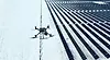
Fly with Precision
RTK UAVs capture data safely and quickly

Process & Quality Check
Rigorous QC ensures accuracy

Deliver & Support
CAD-ready maps, models, and reports delivered securely with expert walkthroughs
Generate high-resolution orthomosaic maps and digital surface models that detect defects, assess storm damage, and calculate areas with pinpoint accuracy. Produce CAD-ready outputs that accelerate insurance claims, maintenance planning, and retrofit projects.
Precision Roof Assessments
Create digital twins of buildings, facilities, and infrastructure for planning, renovations, and asset management. Models integrate seamlessly with BIM and CAD software for construction, engineering, and inspection workflows.
3D Asset Modeling & Mapping
Pinpoint hidden issues such as leaks, insulation failures, and electrical hotspots before they escalate into costly repairs.
Thermal Analytics & Spot Detection
Map entire parking structures and paved areas to identify cracking, ponding, drainage issues, and trip hazards. Data supports proactive maintenance and compliance.
Parking Lot & Hardscape Assessments
Capture high-resolution vertical imagery for facades, towers, and hard-to-access surfaces, all without scaffolding or lifts.
Vertical & Facade Inspections
Extract area, volume, slope, and distance measurements with centimeter-level accuracy for precise planning and reporting.
Custom Measurement & Analysis
Why Precision Asset Mapping Matters

When every inch and every detail matters, guesswork isn’t an option.
FlyCRE Infrastructure delivers accurate, verified, and actionable aerial data that streamlines inspections, reduces risks, and cuts turnaround times.
Benefits at a Glance:

Speed
Inspections completed in hours, not days

Safety
Eliminate the need for scaffolding, ladders, or lifts

Accuracy
RTK-enabled centimeter-level positioning

Versatility
RGB, thermal, and 3D data in one solution
